

adventure
Lordsburg, New Mexico is not just a destination; it's an adventure waiting to be embraced. From rugged hiking trails that wind through the breathtaking Chihuahuan Desert to invigorating off-road adventures that take you deep into the heart of untamed landscapes, Lordsburg offers an adrenaline rush like no other. For those who prefer a slower pace, our serene camping spots and bird-watching areas provide a tranquil escape into nature's wonders.

CONTINENTAL DIVIDE TRAIL
Lordsburg, NM
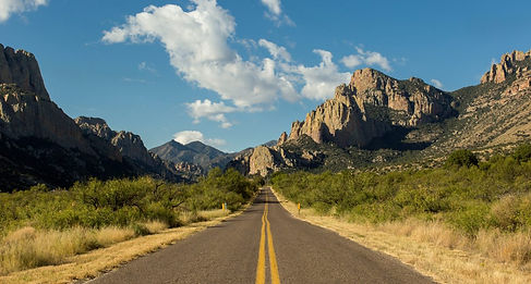
More than a line on a map or a thin stripe of tread, the Continental Divide National Scenic Trail (CDT) is a living connector of communities along the spine of North America, a thriving landscape of unique and precious ecosystems, and a meeting ground where people of all walks of life may unite to live, work, play, worship, and learn. The Continental Divide Trail (CDT), a national scenic trail, is known for the more than 3000 miles it covers from Montana’s Canadian border to Old West Country’s New Mexico border with Mexico.

Gila Lower Box Canyon
Nichol's Canyon, Lordsburg, NM
The Gila Lower Box Canyon is a true oasis in the desert, 20 miles north of Lordsburg. Since livestock were removed from the river canyon in 1990, a lush thicket of cottonwood, willows, and other riparian vegetation have taken over. The area provides some of the best birding opportunities in New Mexico. Home to approximately 200 species, it has one of the highest bird diversities in the state. This area is managed by the Bureau of Land Management. The area provides habitat to many rare and unusual birds including Bell's vireo, peregrine, bald eagle (in winter), golden eagle, black hawk, zone-tail hawk, Grey hawk, yellow-billed cuckoo, Gila wood pecker, and Abert's towhee. The river provides opportunities for canoeing or rafting during spring runoff, hunting, and year-round fishing and dispersed camping. The river contains smallmouth bass and several species of catfish. There are no fees at this area, and also no facilities.

Rodeo, New Mexico
Rodeo, NM
Rodeo has evolved into an art center, attracting artists both in New Mexico and in Arizona. The Chiricahua Art Museum, and various well-known artists invite visitors to explore and enjoy. There are hiking, bird-watching, amenities, and area celebrations (there is always a 4th of July parade) to bring visitors in. The community center is often the hub of community activities and events.

Peloncillo Mountains
Peloncillo Mountains, NM
The Peloncillo Mountains WSA is in southwestern New Mexico and contiguous with the Peloncillo Wilderness in Arizona. The landform is comprised of low mountains, cliffs, and numerous canyons, with gentle hills covered in desert grasses and shrubs. Desert bighorn sheep inhabit the Peloncillo Mountains as well as Gila monsters and pincushion cacti.
Portal, Arizona
Portal, AZ
Portal is an unincorporated community in Cochise County, Arizona, United States. It lies 25 miles south-southeast of San Simon and at the mouth of Cave Creek Canyon on the east side of the Chiricahua Mountains. Often called the Yosemite of Arizona, the rock walled canyon is composed of fused volcanic tuff.

Animas Mountains
Animas, NM
The Animas Mountains are a small mountain range in Hidalgo County, within the "Boot-Heel" region of far southwestern New Mexico, in the United States. They extend north–south for about 30 miles (50 km) along the Continental Divide,[1] from near the town of Animas to a few miles north of the border with Mexico. The range is about 12 miles (20 km) wide at its widest. The highest point of the range is the southern summit of the mile-long Animas Peak massif, 8,565 feet (2,611 m).

Steeple Rock
Virden, NM
The Steeple Rock district consists of over 60 mines. Exploration in the district began about 1860, but production did not begin until 1880. Mining ceased in the early 1900s as the near-surface gold and silver veins were depleted.
City of Rocks State Park
NM 61 (4 mi. NE of US 180) Faywood, NM
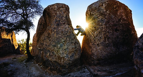
The park encompasses a one square mile area in the scenic Chihuahuan desert region of southwestern New Mexico at an elevation of 5,200 feet. The “city” is a geologic formation made up of large, sculptured rock columns, or pinnacles, rising as high as 40 feet and separated by paths or lanes resembling city streets. These rocks were formed about 34.9 million years ago when a very large volcano erupted. Then, erosion over millions of years slowly formed the sculptured columns seen today, creating a stunning, otherworldly landscape.

Silver City, New Mexico
Silver City, NM
Silver City is a gem in Southwest New Mexico with forest recreation, a vibrant historic downtown, art community, and dozens of festivals and events.Nestled against the 3.3 million acre Gila National Forest, Silver City is a quirky cultural town of just over 10,000 people.
Gila National Forest
3005 E Camino del Bosque, Silver City, NM
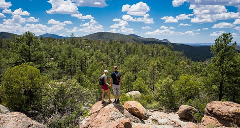
The Gila National Forest has over three million acres of forested hills, majestic mountains, and range land. It is probably best known for its wilderness areas, in particular the Gila Wilderness - the first wilderness in the United States. The magnificent mountain scenery, cool summer temperatures and relatively warm winters permit a wide range of recreational opportunities during all seasons.
